Satellite and Population Embedding
Powerful GeoAI Tools or Overrated?
About Me

Zhanchao Yang
- Master of City Planning (MCP)
- Master of Urban Spatial Analytics (MUSA)
- Bachelor of Arts in Geography, SUNY Binghamton
- Research Assistant, Weitzman School of Design
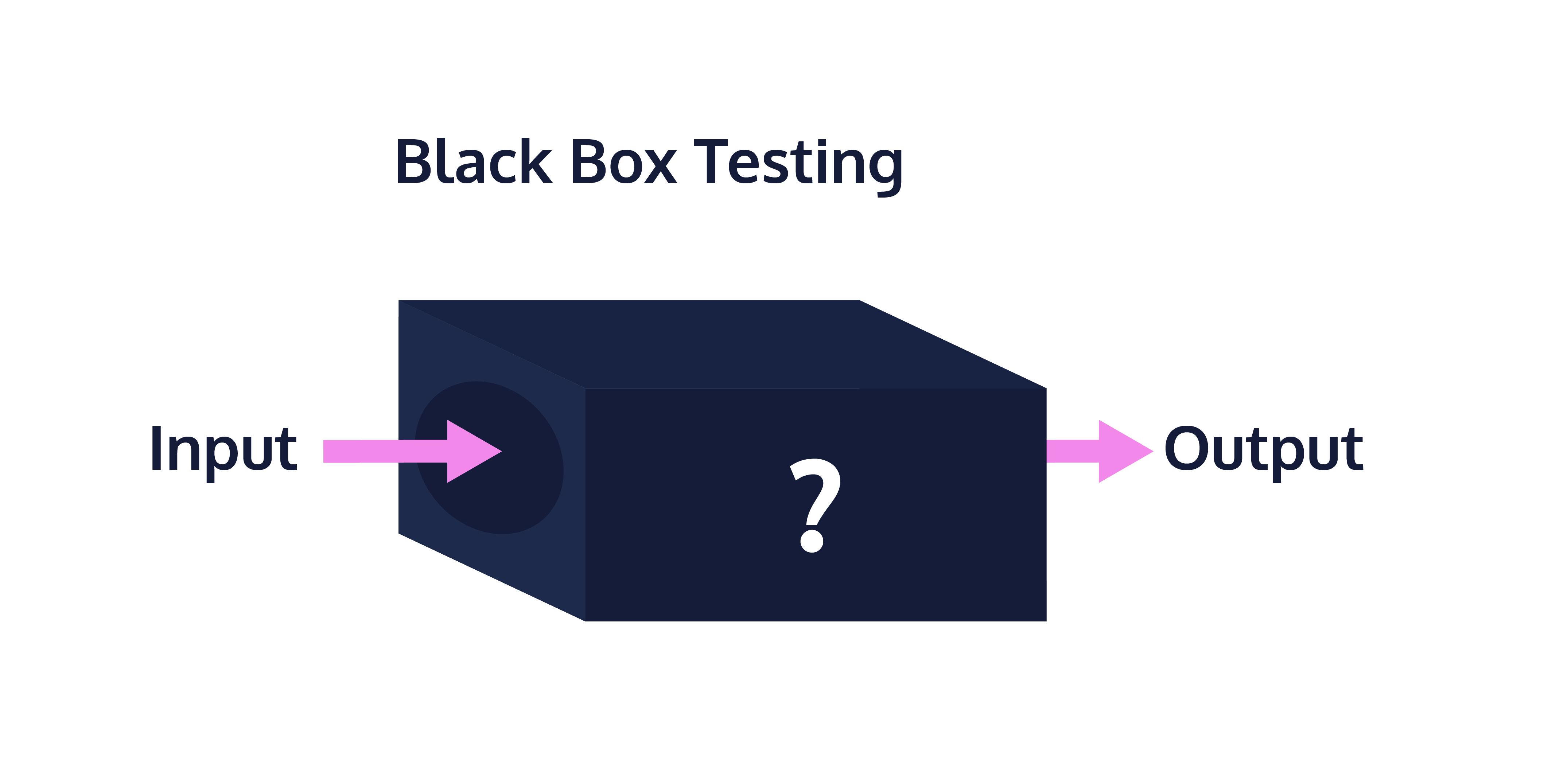
Blackbox Nature of Embeddings
- Generated through various neural network models (GNN or CNN) trained on a large datasets.
- Exact architecture and training process vary widely.
- The company or research institutions may not disclose the full details of their models.
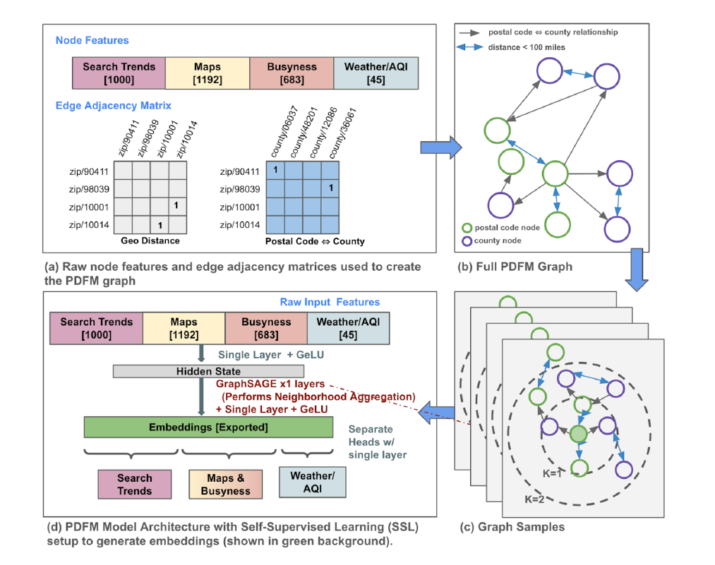
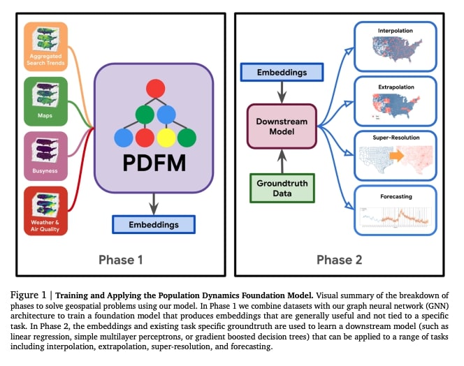
Population Dynamics Foundation (PDFM)
- Developed by Google Research (Google Deep Mind) in 2024.
- Input:
- Census data
- Searching Trends
- Other geospatial data
- Output:
- Multi-dimensional vectors (represent population characteristics and dynamics).
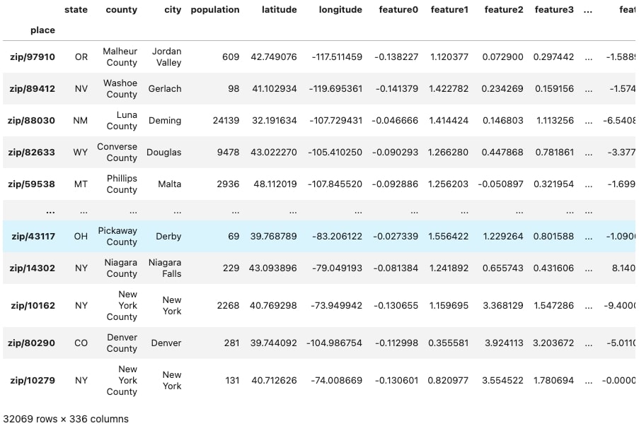
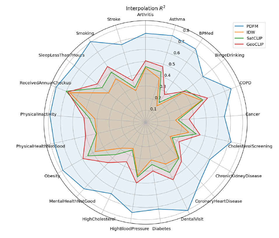
How PDFM Embeddings look like?
- 330-dimensional vectors for each census tract or ZIP code
- Each dimension captures different aspects of population dynamics
- Examples of captured features:
- Mobility patterns
- Search behavior trends
- Local economic activity
- Environmental conditions
Applications of PDFM Embeddings
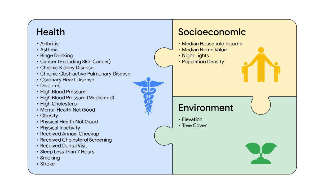
Health & Social Services:
- Disease prevalence prediction
- Healthcare resource allocation
Economic Analysis:
- Socioeconomic indicators
- Income and poverty estimation
Urban Planning:
- Population growth forecasting
- POI and hotspot prediction
Additional Applications
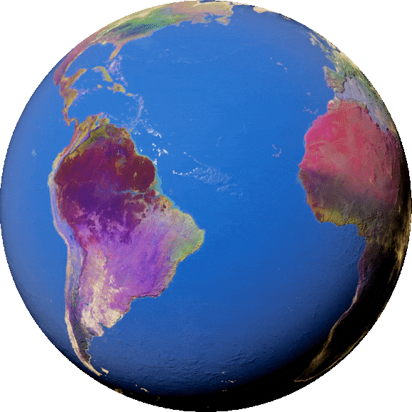
Satellite Foundation Model (SFM) Embeddings
- Developed by Google Research
- Based on Sentinel-2 satellite imagery
- Global coverage (2017-2023)
- Spatial resolution: 10 meters
- Available through Google Earth Engine (GEE)
What Satellite Embeddings Capture?
- Land cover patterns
- Vegetation characteristics
- Urban development
- Environmental changes
- Temporal dynamics
Trained on massive satellite imagery corpus using self-supervised learning
Applications of SFM Embeddings
Environmental and Land Use Planning
- Urban sprawl analysis
- Land cover classification
Temporal Analysis:
- Seasonal pattern detection
- Change Detection
- Similarity searches across time
Demo 2: Satellite Embeddings for Land Cover Classification
Approach:
- Use embeddings as features
- Train classification model
- Predict land cover types
Advantages:
- No need to process raw imagery
- Pre-trained representations
- Faster than traditional methods

Summary and Conclusions
The Promise:
- Powerful tools for spatial analysis
- Capture complex patterns
The Reality:
- Require careful validation
- Complement, not replace
Best Practices:
- Validate predictions thoroughly
- Be aware of limitations and biases